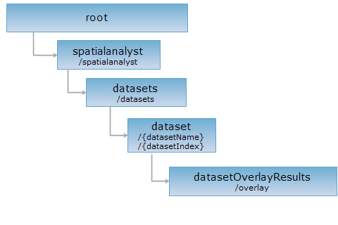
<dataset_uri>/overlay[.<format>]
This is a resource for representing a set of resources of overlay analysis results on datasets.
Supported methods
Supported output formats: rjson, json, html, xml.
http://supermapiserver:8090/iserver/services/spatialanalyst-sample/restjsr/spatialanalyst/datasets/SamplesP@Interpolation/overlay.rjson
Gets a form for the POST request.
Performing a POST request on the resource with related parameters creates the resource of a spatial analysis result, i.e., performs an overlay analysis.
Parameters in the URI are as follows:
| Field | Type | Definition |
| asynchronousReturn | boolean | Whether to adopt asynchronous operation. If true, the URI of the new resource will be immediately returned after the clients submit a request (i.e., the setting of returnContent is not effective); if false, the representation or the URI of the new resource will be returned according to the setting of returnContent once the analysis is finished on the server. The default value is false. |
| returnContent | boolean | Returns the description or the URI of the new resource. If true, returns the description for the analysis result. If false, returns the URI. The default is false. |
Parameters in the request body are as follows:
| Field | Type | Definition |
| operation | String | The overlay operation. Available options includes clip, erase, identity, intersect, union, update, and XOR. The first four operations (clip, erase, identity, intersect) above support a region dataset or area geometric objects data as the operating/overlay dataset, and a point, line, or area dataset as the operated/source dataset. The last three operations above (union, update, XOR) support a region dataset or area geometric objects data as the operating/overlay dataset, and only an area dataset as the operated/source dataset. |
| operateDataset | String | The ID of the operating dataset. |
| operateDatasetFilter | QueryParameter | The condition used for filtering the operating dataset. |
| operateRegions | Geometry[] | The operating regions. If it excluses wth operateDataset, the operateDataset shall prevail. |
| sourceDatasetFilter | QueryParameter | The condition for filtering the source dataset. With filter parameters being set, only the objects that satisfy the condition will participate in the overlay analysis. |
| tolerance | double | The tolerance value used during overlay analysis. If the distance between two nodes is smaller than the tolerance, they will be snapped together. |
| dataReturnOption | DataReturnOption | The settings for returning the extraction result. |
| sourceDatasetFields | String[] | The fields to be copied from the source dataset. |
| operateDatasetFields | String[] | The fields to be copied from the operating dataset. |
Note: If there are fields with identical names in sourceDataset and operateDataset, both fields will be carried through the output dataset with different names assigned. For instance, if both datasets have a field named Code, both Code fields will be preserved in the output dataset. The Code field from the sourceDataset will be named as Code_1 automatically, while the Code field from the operateDataset will be named as Code_2.
Normal response code(s): 201. The response parameters are as follows:
| Name | Type | Description |
|
succeed |
boolean | Whether query is successful. |
| newResourceID | String | The ID of the query result resource. |
| postResultType | PostResultType |
The type of the result from a POST request. Lists and describes the impact of a POST request on the target resource, i.e., the analysis result. |
| newResourceLocation | String | The URI of the newly created resource. |
Below are the parameters for performing a POST request on an Isoline resource http://supermapiserver:8090/iserver/services/spatialanalyst-sample/restjsr/spatialanalyst/datasets/SamplesP@Interpolation/isoline.rjson:
{
"operateDataset": "BoundsR@Interpolation",
"operation": "CLIP",
"tolerance": 0,
"sourceDatasetFilter": {
"attributeFilter": "",
"ids": null
},
"operateDatasetFilter": {
"attributeFilter": "",
"ids": null
},
"dataReturnOption": {
"dataset": "boundClip",
"dataReturnMode": "DATASET_ONLY",
"expectCount": 100,
"deleteExistResultDataset": false
}
}
The response in json format is as follows:
{
"succeed": true,
"newResourceID": "1",
"postResultType": "createChild",
"newResourceLocation": "http://supermapiserver:8090/iserver/services/spatialanalyst-sample/restjsr/spatialanalyst/datasets/SamplesP@Interpolation/overlay/1"
}
Performing a GET request on http://supermapiserver:8090/iserver/services/spatialanalyst-sample/restjsr/spatialanalyst/datasets/SamplesP@Interpolation/overlay/1.rjson can retrieve detailed information on the overlay analysis result. Please seedatasetOverlayResult.
Retrieves the operations and output formats supported by the resource.
Asks for the response identical to the one that would correspond to a GET request, but without the response body. This is useful for retrieving meta-information written in response headers, without having to transport the entire content. The meta-information includes the media-type, content-encoding, transfer-encoding, content-length, etc.
HEAD request can be used to check if the datasetOverlayResults resource exists, or if the resource can be accessed by clients. It can also determine if the datasetOverlayResults resource supports an output format <format> if performed on a URI with .<format> included.